Environmental Assessments
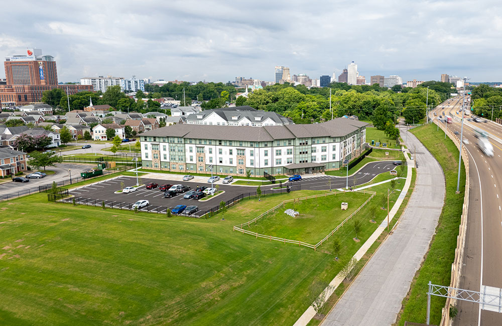
Edgeview II
Former Crankshaft
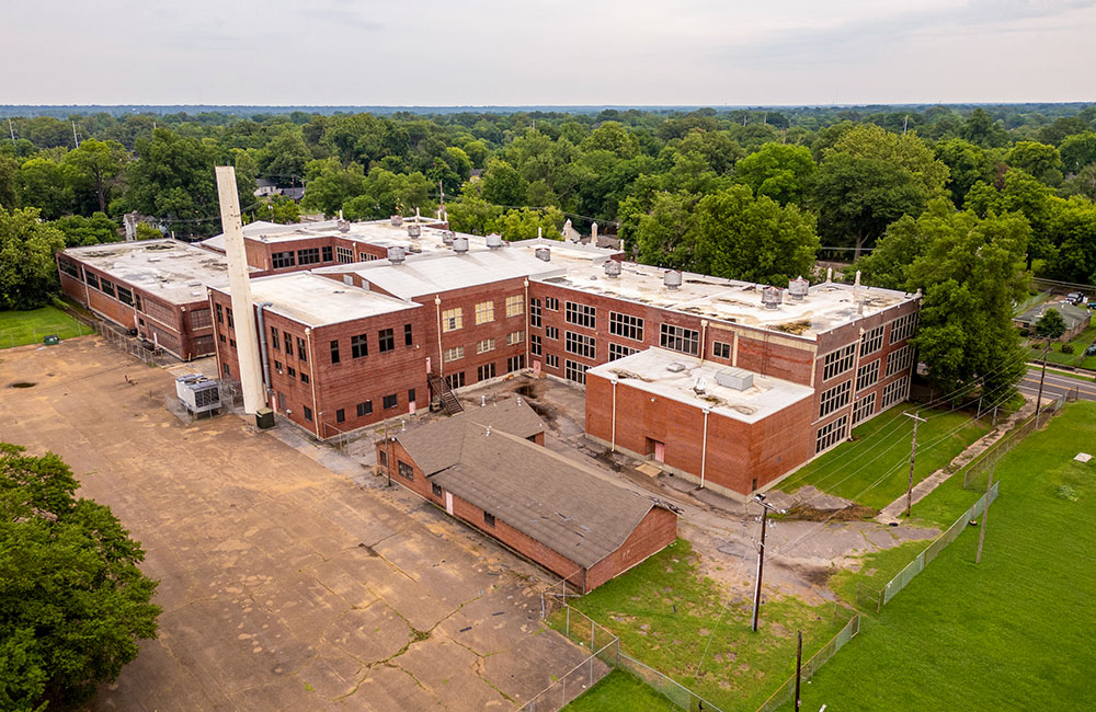
Humes School
2799 Harvard

854 Heiskell

5th and Keel

901 Chelsea Avenue

1344 Jackson Avenue

Future Lamar Pinnacle

Firehouse Row

Vance Avenue

Ibrahim Site

Wayne’s Pinball Palace

Historic St. Thomas Church
Edgeview II
April 14, 2026 | Phase 1
This assessment has revealed the following evidence of RECs in connection with the property:
- The current BVA and the number of sites in the subject property area with reported releases of hazardous substances and/or petroleum products constitute a REC.
- The subject property is subject to Land Use Restrictions, which are considered a CREC.
- The absence of information associated with Minkie Jos, a former clothes cleaner and presser, likely operating at the subject property circa 1921, is considered a significant data gap.
- The absence of information associated with Gordon Cleaners and Dyers, at the historically upgradient south-adjoining address of 311 Decatur Street, is considered a significant data gap.
Former Crankshaft
March 25, 2026 | Phase 1
This assessment has revealed the following evidence of RECs in connection with the property:
- The property is listed in the Sites Remediated with Institutional Controls (INST), Notice of Land Use Restrictions (LUR), Division of Remediation Sites (REMEDIATION), and Voluntary Cleanup, Oversight, and Assistance Program (VCP) databases. Previous uses of the Subject Property as a rug cleaner and crankshaft manufacturer have been identified as RECs in previous reports. A review of available TDEC files indicates that Phase II ESA assessments conducted in 2011 and 2012 on the property identified elevated levels of chromium compounds in soil at depths of approximately six (6) to eighteen (18) inches, and elevated levels of mercury vapor in indoor air samples. Following renovation activities and the re-establishment of HVAC operation, follow-up air samples indicated that the levels of mercury vapor and particulate were below the EPA Industrial Air Regional Screening Levels (RSLs). A portion of the impacted soil was removed. However, due to budgetary constraints and the possibility of damaging underground utilities, further excavation was halted. TDEC agreed to allow the remaining impacted soil to remain in place, subject to certain land-use restrictions. Regulatory closure has not been achieved with TDEC; therefore, the remaining impacted soil represents a REC for the Subject Property.
Humes School
January 12, 2026 | Phase 1
This assessment has revealed the following evidence of RECs in connection with the property:
- The long-term use of a sub-grade boiler and exterior smokestack of unknown fuel source (likely coal and/or fuel oil), including unknown storage and handling.
- The inability to access the gymnasium building located on the northern portion of the subject Property.
- Staining associated with a pad-mounted transformer located on the subject Property.
- The presence of a tank used to store unknown substances located within the former armory building.
- The historical presence of a listed drycleaner on a south adjoining property prior to current registration and regulatory requirements.
- The long-term use of the south adjoining property
2799 Harvard
October 22, 2025 | Phase 1
This assessment has revealed the following evidence of RECs in connection with the property:
- Potential onsite groundwater and soil vapor contamination resulting from the historical use of a nearby upgradient property as a drycleaner.
- The greater than 90-year operational history of a rail line adjacent to the Property represents a material threat of release of oil and/or hazardous substances, which may have migrated onto the subject Property.
If further determination of site conditions is desired, a Phase II ESA should be performed to evaluate and characterize site conditions.
854 Heiskell
October 16, 2025 | Phase 1
This assessment has revealed the following evidence of RECs in connection with the property:
- The presence of numerous chemical drums and containers along with the associated surface staining on the site constitutes a REC due to the potential for releases impacting surface and subsurface media
- The former American Drum & Pallet Company constitutes a REC due to the potential for migration of documented contamination onto the site.
Terracon recommends that a subsurface investigation be performed to evaluate the potential for impact to on-site media as a result of the above-listed RECs.
5th and Keel
August 7, 2025 | Phase 1
This assessment has revealed no evidence of RECs, CRECs, HRECs, VECs, or de minimis conditions in connection with the Subject Property. No further environmental information is recommended to be collected for the Subject Property at this time.
901 Chelsea Avenue
July 28, 2025 | Phase 1
This assessment has revealed no evidence of RECs, CRECs, HRECs, VECs, or de minimis conditions in connection with the Subject Property.
1344 Jackson Avenue
June 19, 2025 | Phase 1
This assessment has revealed evidence of two RECs in connection with the Property. They are as follows:
- The historical drycleaning operations on the north and west adjoining properties prior to environmental regulations and best practices and no records or investigations at those properties represent the potential for a release of drycleaning solvents which may have migrated to the subject Property.
- The possible presence of unregistered petroleum USTs with no records of removal from the east adjoining property represents a material threat of release of petroleum products which has the potential to migrate to the subject Property.
Additionally, based on the approximate date of the subject Property building’s construction (1930), BRS and Tioga suggest a hazardous materials survey for the building prior to renovation or demolition.
Future Lamar Pinnacle
April 25, 2025 | Phase 1
This assessment has revealed the following evidence of RECs in connection with the property:
- The 1927, 1951, 1952, and 1964 Sanborn Maps identify a gasoline tank near the northwest property boundary. FA could not determine whether the underground storage tank (UST) was removed. Based on the proximity to the property, the potential exists for an orphan UST to be present and/or for a release to have occurred from the UST.
- The north-adjacent property, 1730 Lamar Avenue, was occupied by a retail gasoline dispensing station and automotive garage from 1927 until 1997 (70 years), and a dry cleaner from 1943 until 1958 (13 years). Automotive service and dry cleaning operations commonly involve the usage of general hazardous substances and/or petroleum products, which, if improperly managed and/or disposed of, can be a source of contamination. This time period preceded major environmental regulations and current waste management and disposal procedures. The potential exists that a release has occurred on this property and migrated onto the property.
Firehouse Row
March 2025 | Phase 1
This assessment included site reconnaissance, interviews with knowledgeable people, records review, and a report. It is determined that there is no evidence of RECs in connection with the property.
Vance Avenue
March 31, 2025 | Phase 1
This assessment has revealed one REC in connection with the property:
- Potential onsite groundwater and soil vapor contamination resulting from the historical use of the subject property and nearby upgradient properties as dry cleaners.
Ibrahim Site
February 24, 2025 | Phase 1
- This property is listed on the State Remediation Program (SRP) and Voluntary Cleanup Program (VCP) databases. TDEC files indicate that most activities and investigations at the subject property have been mostly limited to the west/southwest portion of the subject property, including the removal of additional USTs and subsurface structures, installation and sampling of groundwater monitoring wells, and soil vapor sampling. Sample results indicate the presence of tetrachloroethene (PCE) in groundwater and soil vapor in the southwest portion of the subject property. Groundwater flow is reported generally to the southwest.
- Chlorinated solvent-contaminated groundwater and soil vapor impacts on the southwest portion of the subject property from historical use as a gas station and/or dry cleaner are considered recognized environmental conditions.
Wayne’s Pinball Palace
February 6, 2025 | Phase 1
This assessment has revealed the following evidence of RECs in connection with the property:
- Based on the historical information reviewed as part of this assessment, the site was previously occupied by an automotive repair facility, two separate gas stations, a furniture repair shop, and a laundromat. Previous subsurface investigations conducted for the site identified petroleum hydrocarbon, PAH, and VOC impact to subsurface media at concentrations exceeding the residential screening levels, which constitutes a REC for the site.
Historic St. Thomas Church
January 13, 2025 | Phase 1
This assessment has revealed the following evidence of RECs in connection with the property:
- The southwest-adjacent property, 565 East Trigg Avenue and 1286 S. Lauderdale, is listed in the EDR HIST AUTO database. The HIST AUTO listing is based on EDR’s city directory archive, which showed that the facility was occupied by a gas station from 1932 through 1963 (31 years). No underground storage tank (UST) files concerning the USTs were available from the Tennessee Department of Environment and Conservation (TDEC). FA was unable to determine whether the USTs were removed from the property. The potential exists for orphan USTs to be present on the property and/or for a release to have occurred from the systems and migrated to the property.
- The southwest-adjacent property, 565 East Trigg Avenue and 1286 S. Lauderdale, was occupied by automotive repair operations from 1968 until 2003 (35 years). Historical interior waste streams associated with the former service garage operations would have consisted of general hazardous substances and/or petroleum products. This time period preceded major environmental regulations and current waste management and disposal procedures. The historical waste management practices associated with the former service operations are unknown and may be a source of subsurface contamination. The potential exists that a release has occurred on this property and migrated onto the property.
- A surrounding property, 543 and 545 E. Trigg Avenue, located approximately 200 feet west-southwest, is identified in the EDR Historical Cleaner (HIST CLEANER) database. A review of the environmental database indicates that the site was occupied by a dry cleaner from 1926 until 1974 (48 years). Dry cleaning operations commonly involve the usage of general hazardous substances and/or petroleum products, which, if improperly managed and/or disposed of, can be a source of contamination. This time period preceded major environmental regulations and current waste management and disposal procedures. The historical waste management practices associated with the former dry cleaning operations are unknown and may be a source of subsurface contamination. Based on the proximity to the property and the long-term dry cleaning operations, the potential exists that a release has occurred and migrated onto the property.